|
Lake And Watershed Facts
General Information:
Land Use Total Acres Percent of Watershed Area Row Crop 4,318 51% Urban/Roads 1,298 15% Grass/Pasture/Hay 811 9% CRP/WRP 723 9% Marsh 719 9% Forest 448 5% Farmstead 137 2%
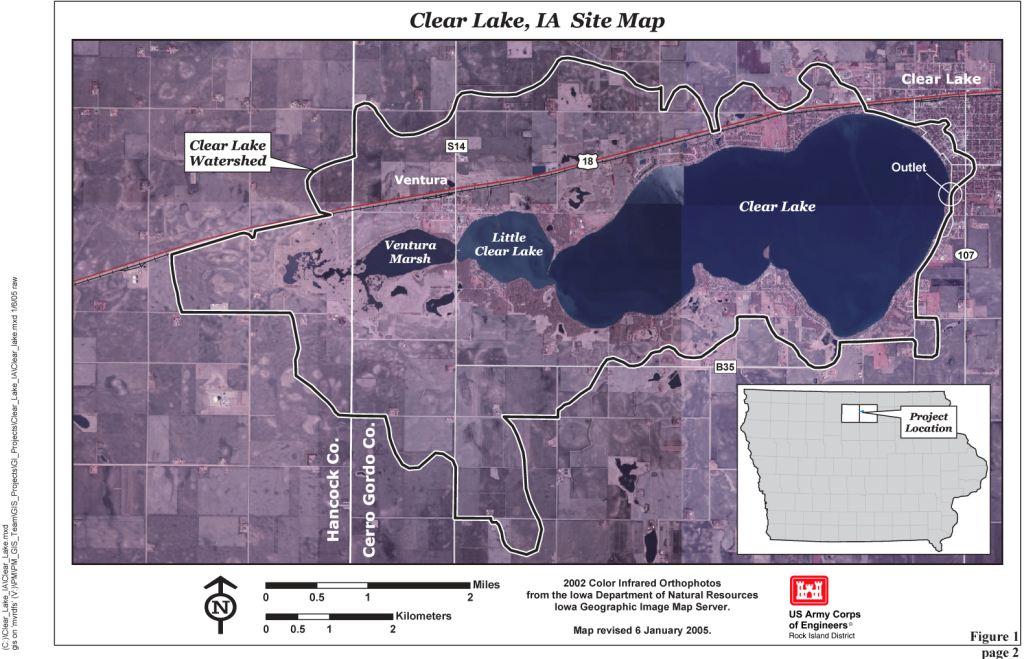
Lake Name: Clear Lake
State: Iowa
County: Cerro Gordo
Nearest Municipalities: Clear Lake, Ventura
Latitude: 43° 08' 01" N (gauging station)
Longitude: 93° 22' 57" W (gauging station)
EPA Region: 7
USGS Major Basin Name: Upper Mississippi
USGS Minor Basin Name: Iowa-Skunk-Wapsipinicon
USGS Hydrologic Unit Code: 07080203
Major Tributaries: Ventura Marsh
Receiving Water Body: Clear Creek
Lake Information:
Lake surface area: 3625 Acres
Maximum depth: 30.0 ft
Mean depth: 9.8 ft
Volume: 35,582 Ac-ft
Length of shoreline: 14.1 mi
Shoreline development index: 1.60
Hydraulic residence time: 5.0 years
Watershed Information:
Watershed area: 8,454 Acres
Watershed area/Lake area ratio: 2.3
Watershed Land Use:
Source: Clear Lake Watershed Management Plan (2011)